
Thank you for supporting this site ❤️
Make a donation
Make a donation
Lowrys Resurvey topographic map
Click on the map to display elevation.
Thank you for supporting this site ❤️
Make a donation
Make a donation
About this map
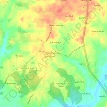
Name: Lowrys Resurvey topographic map, elevation, terrain.
Location: Lowrys Resurvey, Calvert County, Maryland, United States (38.57595 -76.64885 38.61595 -76.60885)
Average elevation: 29 m
Minimum elevation: -2 m
Maximum elevation: 55 m
Thank you for supporting this site ❤️
Make a donation
Make a donation
Other topographic maps
Click on a map to view its topography, its elevation and its terrain.