
ဟားခါးခရိုင် topographic map
Interactive map
Click on the map to display elevation.
About this map
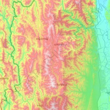
Name: ဟားခါးခရိုင် topographic map, elevation, terrain.
Location: ဟားခါးခရိုင်, État Chin, 03011, Birmanie (22.00574 93.09179 23.07117 94.05786)
Average elevation: 1,028 m
Minimum elevation: 109 m
Maximum elevation: 2,701 m
Other topographic maps
Click on a map to view its topography, its elevation and its terrain.