
Stampfe topographic map
Interactive map
Click on the map to display elevation.
About this map
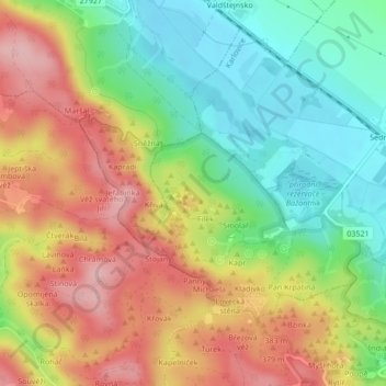
Name: Stampfe topographic map, elevation, terrain.
Average elevation: 328 m
Minimum elevation: 249 m
Maximum elevation: 418 m
Other topographic maps
Click on a map to view its topography, its elevation and its terrain.
Manon
Tschechien > Nordosten > Reichenberger Region > Karlowitz
Manon, Karlowitz, Bezirk Semil, Reichenberger Region, Nordosten, 511 01, Tschechien
Average elevation: 333 m