
Thank you for supporting this site ❤️
Make a donation
Make a donation
Linden topographic map
Click on the map to display elevation.
Thank you for supporting this site ❤️
Make a donation
Make a donation
About this map
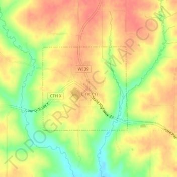
Name: Linden topographic map, elevation, terrain.
Location: Linden, Iowa County, Wisconsin, 53553, United States (42.91213 -90.28291 42.92491 -90.26525)
Average elevation: 332 m
Minimum elevation: 294 m
Maximum elevation: 356 m
Thank you for supporting this site ❤️
Make a donation
Make a donation
Other topographic maps
Click on a map to view its topography, its elevation and its terrain.
Thank you for supporting this site ❤️
Make a donation
Make a donation
Tower Hill State Park
United States > Wisconsin > Iowa County > Town of Wyoming
Average elevation: 233 m