
Thank you for supporting this site ❤️
Make a donation
Make a donation
University Place topographic map
Click on the map to display elevation.
Thank you for supporting this site ❤️
Make a donation
Make a donation
About this map
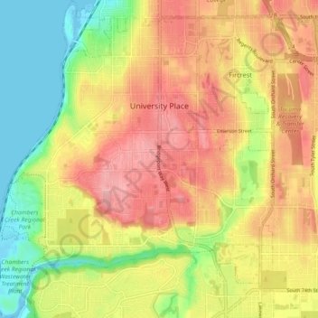
Name: University Place topographic map, elevation, terrain.
Location: University Place, Pierce County, Washington, United States (47.18514 -122.58415 47.24593 -122.50521)
Average elevation: 72 m
Minimum elevation: -2 m
Maximum elevation: 137 m
Thank you for supporting this site ❤️
Make a donation
Make a donation
Other topographic maps
Click on a map to view its topography, its elevation and its terrain.