
Kalyan-Dombivli topographic map
Interactive map
Click on the map to display elevation.
About this map
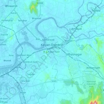
Name: Kalyan-Dombivli topographic map, elevation, terrain.
Location: Kalyan-Dombivli, Kalyan, Thane, Maharashtra, India (19.14218 73.06123 19.31183 73.23993)
Average elevation: 25 m
Minimum elevation: -4 m
Maximum elevation: 596 m
Other topographic maps
Click on a map to view its topography, its elevation and its terrain.