
Thank you for supporting this site ❤️
Make a donation
Make a donation
McKey topographic map
Click on the map to display elevation.
Thank you for supporting this site ❤️
Make a donation
Make a donation
About this map
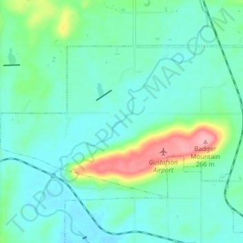
Name: McKey topographic map, elevation, terrain.
Location: McKey, Sequoyah County, Oklahoma, United States (35.47458 -94.88505 35.50705 -94.82077)
Average elevation: 175 m
Minimum elevation: 149 m
Maximum elevation: 270 m
Thank you for supporting this site ❤️
Make a donation
Make a donation
Other topographic maps
Click on a map to view its topography, its elevation and its terrain.