
Fish Lake topographic map
Interactive map
Click on the map to display elevation.
About this map
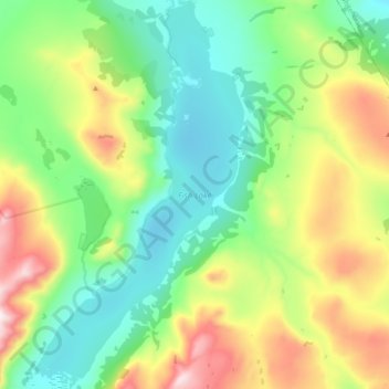
Name: Fish Lake topographic map, elevation, terrain.
Location: Fish Lake, Yukon, Canada (60.55562 -135.31216 60.65041 -135.20791)
Average elevation: 1,314 m
Minimum elevation: 1,080 m
Maximum elevation: 1,804 m
Other topographic maps
Click on a map to view its topography, its elevation and its terrain.