
Thank you for supporting this site ❤️
Make a donation
Make a donation
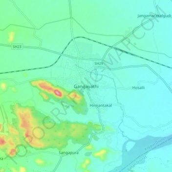
Gangavathi topographic map
Click on the map to display elevation.
Thank you for supporting this site ❤️
Make a donation
Make a donation
Gangavathi
Gangavathi lies at an average elevation of 406 metres (1,332 ft), and is situated close to the Tungabhadra Dam. It is a taluka (administrative division) of Koppal, a district that was previously part of Raichur.
Thank you for supporting this site ❤️
Make a donation
Make a donation
About this map
Name: Gangavathi topographic map, elevation, terrain.
Location: Gangavathi, Gangavati taluku, Koppal, Karnataka, 583227, India (15.38611 76.49067 15.46611 76.57067)
Average elevation: 421 m
Minimum elevation: 384 m
Maximum elevation: 588 m
Thank you for supporting this site ❤️
Make a donation
Make a donation