
Guttenberg topographic map
Interactive map
Click on the map to display elevation.
About this map
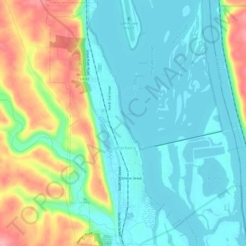
Name: Guttenberg topographic map, elevation, terrain.
Average elevation: 218 m
Minimum elevation: 182 m
Maximum elevation: 301 m
Other topographic maps
Click on a map to view its topography, its elevation and its terrain.
Luana
Vereinigte Staaten von Amerika > Iowa > Clayton County
Luana, Clayton County, Iowa, 52156, Vereinigte Staaten von Amerika
Average elevation: 335 m