
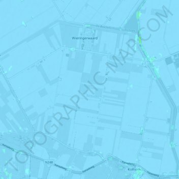
Wieringerwaard topographic map
Interactive map
Click on the map to display elevation.
About this map
Name: Wieringerwaard topographic map, elevation, terrain.
Location: Wieringerwaard, Hollands Kroon, Noord-Holland, Nederland (52.79807 4.81281 52.84505 4.91236)
Average elevation: -2 m
Minimum elevation: -6 m
Maximum elevation: 6 m
Other topographic maps
Click on a map to view its topography, its elevation and its terrain.
Nieuwe Niedorp
Nederland > Noord-Holland > Hollands Kroon
Nieuwe Niedorp, Hollands Kroon, Noord-Holland, Nederland
Average elevation: -1 m
Barsingerhorn
Nederland > Noord-Holland > Hollands Kroon
Barsingerhorn, Hollands Kroon, Noord-Holland, Nederland
Average elevation: -1 m
't Veld
Nederland > Noord-Holland > Hollands Kroon > 't Veld
't Veld, Hollands Kroon, Noord-Holland, Nederland
Average elevation: -1 m
Zijdewind
Nederland > Noord-Holland > Hollands Kroon > Zijdewind
Zijdewind, Hollands Kroon, Noord-Holland, Nederland
Average elevation: -1 m
Wieringerwerf
Nederland > Noord-Holland > Hollands Kroon > Wieringerwerf
Wieringerwerf, Hollands Kroon, Noord-Holland, Nederland, 1771, Nederland
Average elevation: -4 m