
Big Foot Beach State Park topographic map
Interactive map
Click on the map to display elevation.
About this map
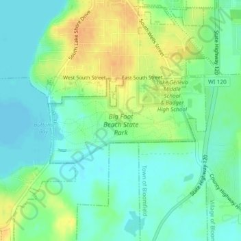
Name: Big Foot Beach State Park topographic map, elevation, terrain.
Average elevation: 276 m
Minimum elevation: 262 m
Maximum elevation: 297 m
Other topographic maps
Click on a map to view its topography, its elevation and its terrain.
Geneva Lake
United States > Wisconsin > Walworth County > Lake Geneva
Geneva Lake, Lake Geneva, Town of Linn, Walworth County, Wisconsin, 53125, United States
Average elevation: 288 m