
Dent du Loup topographic map
Interactive map
Click on the map to display elevation.
About this map
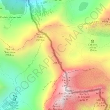
Name: Dent du Loup topographic map, elevation, terrain.
Location: Dent du Loup, Vouvry, Monthey, Wallis, 1896, Schweiz (46.34128 6.78033 46.34138 6.78043)
Average elevation: 1,879 m
Minimum elevation: 1,387 m
Maximum elevation: 2,394 m