
Lanesboro topographic map
Interactive map
Click on the map to display elevation.
About this map
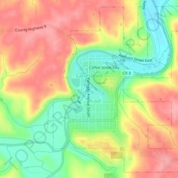
Name: Lanesboro topographic map, elevation, terrain.
Location: Lanesboro, Fillmore County, Minnesota, 55949, United States (43.70611 -91.98443 43.73134 -91.95456)
Average elevation: 299 m
Minimum elevation: 242 m
Maximum elevation: 349 m