
Thank you for supporting this site ❤️
Make a donation
Make a donation
Lexington topographic map
Click on the map to display elevation.
Thank you for supporting this site ❤️
Make a donation
Make a donation
About this map
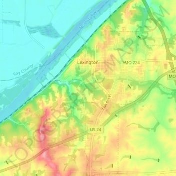
Name: Lexington topographic map, elevation, terrain.
Location: Lexington, Lafayette County, Missouri, 64067, United States (39.14888 -93.90401 39.20505 -93.83357)
Average elevation: 242 m
Minimum elevation: 204 m
Maximum elevation: 295 m
Thank you for supporting this site ❤️
Make a donation
Make a donation