
Thank you for supporting this site ❤️
Make a donation
Make a donation
Wittersham topographic map
Click on the map to display elevation.
Thank you for supporting this site ❤️
Make a donation
Make a donation
About this map
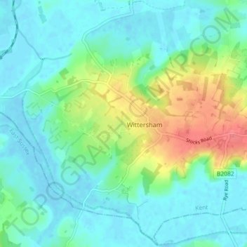
Name: Wittersham topographic map, elevation, terrain.
Location: Wittersham, Ashford, Kent, England, United Kingdom (50.99358 0.66207 51.03807 0.73369)
Average elevation: 18 m
Minimum elevation: -3 m
Maximum elevation: 68 m
Thank you for supporting this site ❤️
Make a donation
Make a donation
Other topographic maps
Click on a map to view its topography, its elevation and its terrain.