
District Council of Robe topographic map
Interactive map
Click on the map to display elevation.
About this map
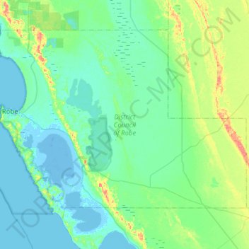
Name: District Council of Robe topographic map, elevation, terrain.
Location: District Council of Robe, South Australia, 5276, Australia (-37.34006 139.73722 -37.03247 140.24365)
Average elevation: 12 m
Minimum elevation: -9 m
Maximum elevation: 69 m
Other topographic maps
Click on a map to view its topography, its elevation and its terrain.