
Thank you for supporting this site ❤️
Make a donation
Make a donation
Charlevoix County topographic map
Click on the map to display elevation.
Thank you for supporting this site ❤️
Make a donation
Make a donation
About this map
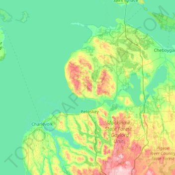
Name: Charlevoix County topographic map, elevation, terrain.
Location: Charlevoix County, Michigan, United States (45.11507 -85.84424 45.84157 -84.73262)
Average elevation: 215 m
Minimum elevation: 162 m
Maximum elevation: 465 m
Thank you for supporting this site ❤️
Make a donation
Make a donation
Other topographic maps
Click on a map to view its topography, its elevation and its terrain.