
上八里镇 topographic map
Interactive map
Click on the map to display elevation.
About this map
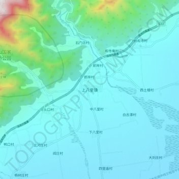
Name: 上八里镇 topographic map, elevation, terrain.
Location: 上八里镇, 辉县市, 新乡市, 河南省, 中国 (35.49590 113.56100 35.57590 113.64100)
Average elevation: 276 m
Minimum elevation: 98 m
Maximum elevation: 1,556 m