
Thank you for supporting this site ❤️
Make a donation
Make a donation
Ilam topographic map
Click on the map to display elevation.
Thank you for supporting this site ❤️
Make a donation
Make a donation
Ilam
The word ‘Ilam’ comprises two words-‘I’ and ‘Lam’. In Limbu language, the word ‘I’ means ‘winding’ and ‘lam’ denotes the way. The topography of this Ilam aptly depicts several winding paths crisscrossing.
Thank you for supporting this site ❤️
Make a donation
Make a donation
About this map
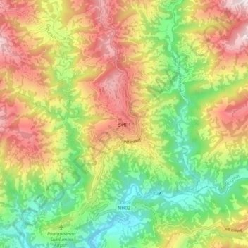
Name: Ilam topographic map, elevation, terrain.
Location: Ilam, Illam, Ilam, Koshi Province, 57300, Nepal (26.87039 87.88819 26.95039 87.96819)
Average elevation: 919 m
Minimum elevation: 419 m
Maximum elevation: 1,522 m
Thank you for supporting this site ❤️
Make a donation
Make a donation