
Minaret Summit topographic map
Interactive map
Click on the map to display elevation.
About this map
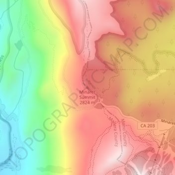
Name: Minaret Summit topographic map, elevation, terrain.
Average elevation: 2,675 m
Minimum elevation: 2,324 m
Maximum elevation: 2,940 m
Other topographic maps
Click on a map to view its topography, its elevation and its terrain.
Mammoth Lakes
Vereinigte Staaten von Amerika > Kalifornien > Mammoth Lakes
Mammoth Lakes, Mono County, Kalifornien, Vereinigte Staaten von Amerika
Average elevation: 2,687 m