
Мамысантысых topographic map
Interactive map
Click on the map to display elevation.
About this map
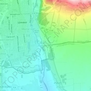
Name: Мамысантысых topographic map, elevation, terrain.
Location: Мамысантысых, Tskhinvali, Ossétie du Sud, Géorgie (42.19484 43.96460 42.23484 44.00460)
Average elevation: 885 m
Minimum elevation: 816 m
Maximum elevation: 1,084 m