
Thank you for supporting this site ❤️
Make a donation
Make a donation
Heritage topographic map
Click on the map to display elevation.
Thank you for supporting this site ❤️
Make a donation
Make a donation
About this map
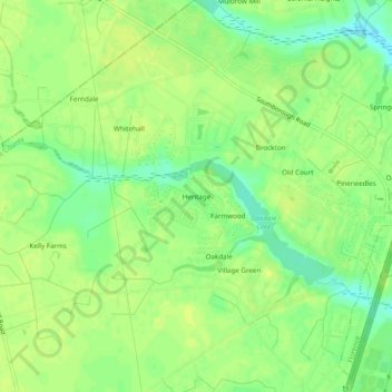
Name: Heritage topographic map, elevation, terrain.
Location: Heritage, Florence County, South Carolina, United States (34.15988 -79.90979 34.19988 -79.86979)
Average elevation: 44 m
Minimum elevation: 32 m
Maximum elevation: 51 m
Thank you for supporting this site ❤️
Make a donation
Make a donation
Other topographic maps
Click on a map to view its topography, its elevation and its terrain.