
Road Town topographic map
Interactive map
Click on the map to display elevation.
About this map
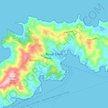
Name: Road Town topographic map, elevation, terrain.
Location: Road Town, VG 1110, British Virgin Islands (18.38571 -64.66322 18.46571 -64.58322)
Average elevation: 82 m
Minimum elevation: -1 m
Maximum elevation: 513 m