
Jackson County topographic map
Interactive map
Click on the map to display elevation.
About this map
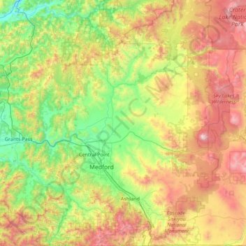
Name: Jackson County topographic map, elevation, terrain.
Location: Jackson County, Oregon, Vereinigte Staaten von Amerika (42.00312 -123.23134 42.99662 -122.28191)
Average elevation: 1,021 m
Minimum elevation: 189 m
Maximum elevation: 2,872 m