
Thank you for supporting this site ❤️
Make a donation
Make a donation
Guymon topographic map
Click on the map to display elevation.
Thank you for supporting this site ❤️
Make a donation
Make a donation
About this map
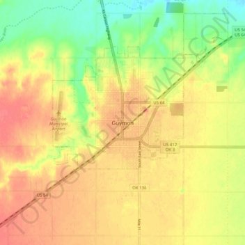
Name: Guymon topographic map, elevation, terrain.
Location: Guymon, Texas County, Oklahoma, 73942, United States (36.64280 -101.52155 36.72280 -101.44155)
Average elevation: 940 m
Minimum elevation: 902 m
Maximum elevation: 969 m
Thank you for supporting this site ❤️
Make a donation
Make a donation