
Saint-Christophe-sur-Dolaison topographic map
Interactive map
Click on the map to display elevation.
Saint-Christophe-sur-Dolaison
Son altitude varie de 763 à 1069 mètres, sa mairie se trouvant à 911 mètres.
About this map
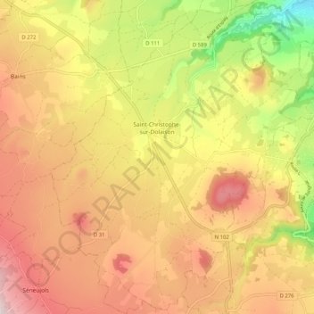
Name: Saint-Christophe-sur-Dolaison topographic map, elevation, terrain.
Average elevation: 934 m
Minimum elevation: 664 m
Maximum elevation: 1,143 m