
Polonnaruwa District topographic map
Interactive map
Click on the map to display elevation.
About this map
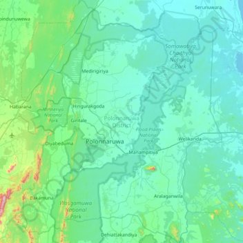
Name: Polonnaruwa District topographic map, elevation, terrain.
Location: Polonnaruwa District, North Central Province, Sri Lanka (7.64696 80.74936 8.34532 81.34014)
Average elevation: 82 m
Minimum elevation: 0 m
Maximum elevation: 818 m
Other topographic maps
Click on a map to view its topography, its elevation and its terrain.