
Columbia River topographic map
Interactive map
Click on the map to display elevation.
About this map
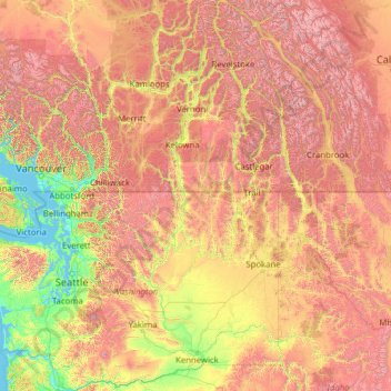
Name: Columbia River topographic map, elevation, terrain.
Average elevation: 1,102 m
Minimum elevation: -2 m
Maximum elevation: 4,151 m
Other topographic maps
Click on a map to view its topography, its elevation and its terrain.
Mazama
Vereinigte Staaten von Amerika > Washington > Okanogan County > Mazama
Mazama, Okanogan County, Washington, 98833, Vereinigte Staaten von Amerika
Average elevation: 827 m