
Channasandra topographic map
Interactive map
Click on the map to display elevation.
About this map
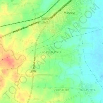
Name: Channasandra topographic map, elevation, terrain.
Location: Channasandra, Madduru taluk, Mandya District, Karnataka, India (12.54972 77.01767 12.58972 77.05767)
Average elevation: 639 m
Minimum elevation: 617 m
Maximum elevation: 668 m