
Herlan Peak topographic map
Interactive map
Click on the map to display elevation.
About this map
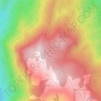
Name: Herlan Peak topographic map, elevation, terrain.
Average elevation: 2,425 m
Minimum elevation: 2,001 m
Maximum elevation: 2,692 m
Other topographic maps
Click on a map to view its topography, its elevation and its terrain.
Sparks
États-Unis d'Amérique > Nevada > Washoe County > Sparks
Sparks, Washoe County, Nevada, États-Unis d'Amérique
Average elevation: 1,438 m
Reno
États-Unis d'Amérique > Nevada > Washoe County
Reno, Washoe County, Nevada, États-Unis d'Amérique
Average elevation: 1,650 m
Granite Point
États-Unis d'Amérique > Nevada > Washoe County
Granite Point, Washoe County, Nevada, États-Unis d'Amérique
Average elevation: 1,273 m