
Le Perron topographic map
Interactive map
Click on the map to display elevation.
About this map
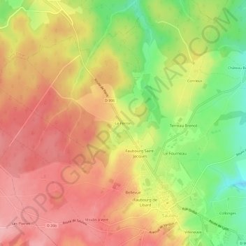
Name: Le Perron topographic map, elevation, terrain.
Average elevation: 540 m
Minimum elevation: 461 m
Maximum elevation: 595 m
Other topographic maps
Click on a map to view its topography, its elevation and its terrain.
Villeneuve
France > Bourgogne-Franche-Comté > Côte-d'Or > Saulieu
Villeneuve, Saulieu, Montbard, Côte-d'Or, Bourgogne-Franche-Comté, France métropolitaine, 21210, France
Average elevation: 523 m