
Thank you for supporting this site ❤️
Make a donation
Make a donation
Santa Clara topographic map
Click on the map to display elevation.
Thank you for supporting this site ❤️
Make a donation
Make a donation
About this map
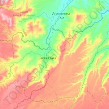
Name: Santa Clara topographic map, elevation, terrain.
Location: Santa Clara, Pastaza, Ecuador (-1.36474 -77.97081 -1.14702 -77.72426)
Average elevation: 809 m
Minimum elevation: 446 m
Maximum elevation: 1,263 m
Thank you for supporting this site ❤️
Make a donation
Make a donation