
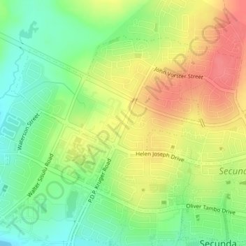
Govan Mbeki Ward 21 topographic map
Interactive map
Click on the map to display elevation.
About this map
Name: Govan Mbeki Ward 21 topographic map, elevation, terrain.
Average elevation: 1,621 m
Minimum elevation: 1,588 m
Maximum elevation: 1,655 m
Other topographic maps
Click on a map to view its topography, its elevation and its terrain.
Govan Mbeki
RSA > Mpumalanga > Govan Mbeki
Govan Mbeki, Gert Sibande, Mpumalanga, 2302, RSA
Average elevation: 1,612 m