
Thank you for supporting this site ❤️
Make a donation
Make a donation
Kohīma topographic map
Click on the map to display elevation.
Thank you for supporting this site ❤️
Make a donation
Make a donation
About this map
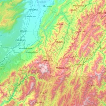
Name: Kohīma topographic map, elevation, terrain.
Location: Kohīma, Kohima, Nagaland, India (25.05000 93.46667 26.45000 94.86667)
Average elevation: 1,001 m
Minimum elevation: 93 m
Maximum elevation: 2,997 m
Thank you for supporting this site ❤️
Make a donation
Make a donation