
Malgretoute topographic map
Interactive map
Click on the map to display elevation.
About this map
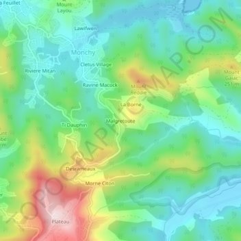
Name: Malgretoute topographic map, elevation, terrain.
Location: Malgretoute, Monchy, Gros Islet, LC01 301, St. Lucia (14.02192 -60.94361 14.06192 -60.90361)
Average elevation: 122 m
Minimum elevation: 0 m
Maximum elevation: 393 m