
Thank you for supporting this site ❤️
Make a donation
Make a donation
Randers Municipality topographic map
Click on the map to display elevation.
Thank you for supporting this site ❤️
Make a donation
Make a donation
About this map
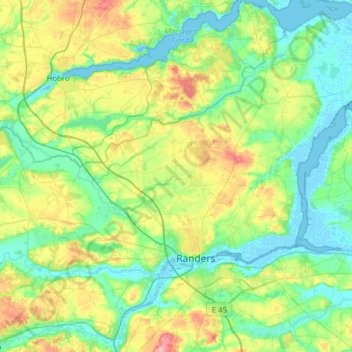
Name: Randers Municipality topographic map, elevation, terrain.
Location: Randers Municipality, Central Denmark Region, Denmark (56.36989 9.77621 56.71213 10.36313)
Average elevation: 33 m
Minimum elevation: -3 m
Maximum elevation: 129 m
Thank you for supporting this site ❤️
Make a donation
Make a donation
Other topographic maps
Click on a map to view its topography, its elevation and its terrain.