
Ledeberg topographic map
Interactive map
Click on the map to display elevation.
About this map
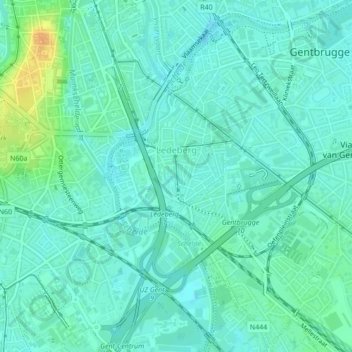
Name: Ledeberg topographic map, elevation, terrain.
Location: Ledeberg, Ghent, Gent, East Flanders, Flanders, Belgium (51.02812 3.73301 51.04218 3.75074)
Average elevation: 11 m
Minimum elevation: 3 m
Maximum elevation: 33 m