
Thank you for supporting this site ❤️
Make a donation
Make a donation
Milford topographic map
Click on the map to display elevation.
Thank you for supporting this site ❤️
Make a donation
Make a donation
About this map
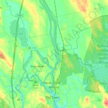
Name: Milford topographic map, elevation, terrain.
Location: Milford, Penobscot County, Maine, 04461, United States (44.92395 -68.64916 45.03936 -68.49184)
Average elevation: 40 m
Minimum elevation: 22 m
Maximum elevation: 79 m
Thank you for supporting this site ❤️
Make a donation
Make a donation
Other topographic maps
Click on a map to view its topography, its elevation and its terrain.
Thank you for supporting this site ❤️
Make a donation
Make a donation
Thank you for supporting this site ❤️
Make a donation
Make a donation