
Bad Segeberg topographic map
Interactive map
Click on the map to display elevation.
About this map
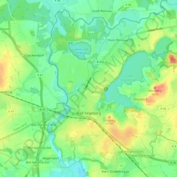
Name: Bad Segeberg topographic map, elevation, terrain.
Average elevation: 39 m
Minimum elevation: 16 m
Maximum elevation: 80 m
Other topographic maps
Click on a map to view its topography, its elevation and its terrain.
Schieren
Allemagne > Schleswig-Holstein > Kreis Segeberg
Schieren, Trave-Land, Kreis Segeberg, Schleswig-Holstein, Allemagne
Average elevation: 41 m