
La Louisière topographic map
Interactive map
Click on the map to display elevation.
About this map
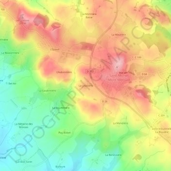
Name: La Louisière topographic map, elevation, terrain.
Average elevation: 206 m
Minimum elevation: 125 m
Maximum elevation: 281 m
Other topographic maps
Click on a map to view its topography, its elevation and its terrain.
La Chambaudière
France > Pays de la Loire > Vendée > Sèvremont > Saint-Michel-Mont-Mercure > La Chambaudière
La Chambaudière, Saint-Michel-Mont-Mercure, Sèvremont, Fontenay-le-Comte, Vendée, Pays de la Loire, France métropolitaine, 85700, France
Average elevation: 164 m