
Culion topographic map
Click on the map to display elevation.
About this map
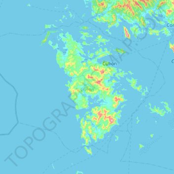
Name: Culion topographic map, elevation, terrain.
Location: Culion, Palawan, Mimaropa, 5315, Philippines (11.61474 119.68176 12.00996 120.18138)
Average elevation: 22 m
Minimum elevation: -1 m
Maximum elevation: 626 m
Other topographic maps
Click on a map to view its topography, its elevation and its terrain.