
Thank you for supporting this site ❤️
Make a donation
Make a donation
Chilworth topographic map
Click on the map to display elevation.
Thank you for supporting this site ❤️
Make a donation
Make a donation
About this map
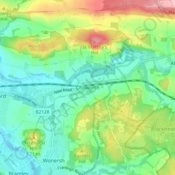
Name: Chilworth topographic map, elevation, terrain.
Location: Chilworth, Guildford, Surrey, England, GU4 8NR, United Kingdom (51.19419 -0.55191 51.23419 -0.51191)
Average elevation: 82 m
Minimum elevation: 34 m
Maximum elevation: 180 m
Thank you for supporting this site ❤️
Make a donation
Make a donation
Other topographic maps
Click on a map to view its topography, its elevation and its terrain.