
Besch topographic map
Interactive map
Click on the map to display elevation.
About this map
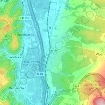
Name: Besch topographic map, elevation, terrain.
Location: Besch, Perl, Landkreis Merzig-Wadern, Saarland, Deutschland (49.48167 6.36104 49.52504 6.40572)
Average elevation: 196 m
Minimum elevation: 136 m
Maximum elevation: 374 m