
Thank you for supporting this site ❤️
Make a donation
Make a donation
Stade topographic map
Click on the map to display elevation.
Thank you for supporting this site ❤️
Make a donation
Make a donation
About this map
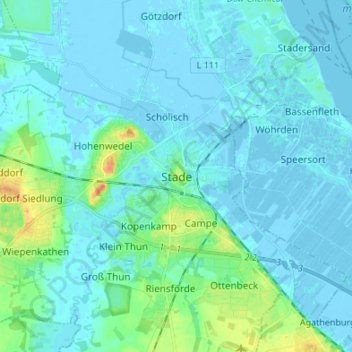
Name: Stade topographic map, elevation, terrain.
Location: Stade, Lower Saxony, 21680, Germany (53.55979 9.43544 53.63979 9.51544)
Average elevation: 5 m
Minimum elevation: -5 m
Maximum elevation: 36 m
Thank you for supporting this site ❤️
Make a donation
Make a donation