
Make a donation
Diemitz topographic map
Click on the map to display elevation.
Make a donation
Diemitz
Altstadt | Ammendorf/Beesen | Am Wasserturm/Thaerviertel | Böllberg/Wörmlitz | Büschdorf | Damaschkestraße | Dautzsch | Diemitz | Dieselstraße | Dölau | Dölauer Heide | Freiimfelde/Kanenaer Weg | Frohe Zukunft | Gebiet der DR | Gesundbrunnen | Gewerbegebiet Neustadt | Giebichenstein | Gottfried-Keller-Siedlung | Heide-Nord/Blumenau | Heide-Süd | Industriegebiet Nord | Kanena/Bruckdorf | Kröllwitz | Landrain | Lettin | Lutherplatz/Thüringer Bahnhof | Mötzlich | Nietleben | Nördliche Innenstadt | Nördliche Neustadt | Paulusviertel | Planena | Radewell/Osendorf | Reideburg | Saaleaue | Seeben | Silberhöhe | Südliche Innenstadt | Südliche Neustadt | Südstadt | Tornau | Trotha | Westliche Neustadt
Make a donation
About this map
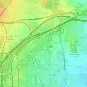
Name: Diemitz topographic map, elevation, terrain.
Location: Diemitz, Halle (Saale), Sachsen-Anhalt, Deutschland (51.48358 11.99252 51.50218 12.01807)
Average elevation: 109 m
Minimum elevation: 95 m
Maximum elevation: 123 m
Make a donation
Other topographic maps
Click on a map to view its topography, its elevation and its terrain.