
Oldemburgo topographic map
Interactive map
Click on the map to display elevation.
About this map
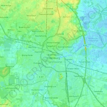
Name: Oldemburgo topographic map, elevation, terrain.
Location: Oldemburgo, Baixa Saxônia, Alemanha (53.08312 8.12952 53.20476 8.31221)
Average elevation: 7 m
Minimum elevation: -3 m
Maximum elevation: 27 m