
Thendara topographic map
Interactive map
Click on the map to display elevation.
About this map
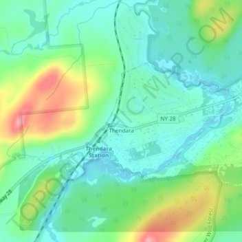
Name: Thendara topographic map, elevation, terrain.
Average elevation: 541 m
Minimum elevation: 507 m
Maximum elevation: 616 m
Other topographic maps
Click on a map to view its topography, its elevation and its terrain.
Mountain Lodge
Vereinigte Staaten von Amerika > New York > Herkimer County
Mountain Lodge, Town of Webb, Herkimer County, New York, 13420, Vereinigte Staaten von Amerika
Average elevation: 562 m