
Salinas topographic map
Interactive map
Click on the map to display elevation.
About this map
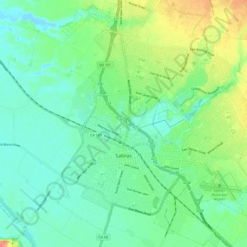
Name: Salinas topographic map, elevation, terrain.
Average elevation: 19 m
Minimum elevation: -2 m
Maximum elevation: 61 m
Other topographic maps
Click on a map to view its topography, its elevation and its terrain.
Metz
États-Unis d'Amérique > Californie > Monterey County > Metz
Metz, Monterey County, Californie, États-Unis d'Amérique
Average elevation: 120 m