
Weststellingwerf topographic map
Interactive map
Click on the map to display elevation.
About this map
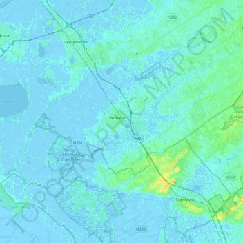
Name: Weststellingwerf topographic map, elevation, terrain.
Location: Weststellingwerf, Friesland, Niederlande (52.80072 5.81811 52.94301 6.24726)
Average elevation: 2 m
Minimum elevation: -5 m
Maximum elevation: 20 m